

INDONESIA — A magnitude Mw (Magnitude) 7.7 earthquake struck the Flores Sea on August 15 at 5:58 a.m. local time (9:58 p.m. UTC on August 14) at a depth of 6.2 miles (10 km).
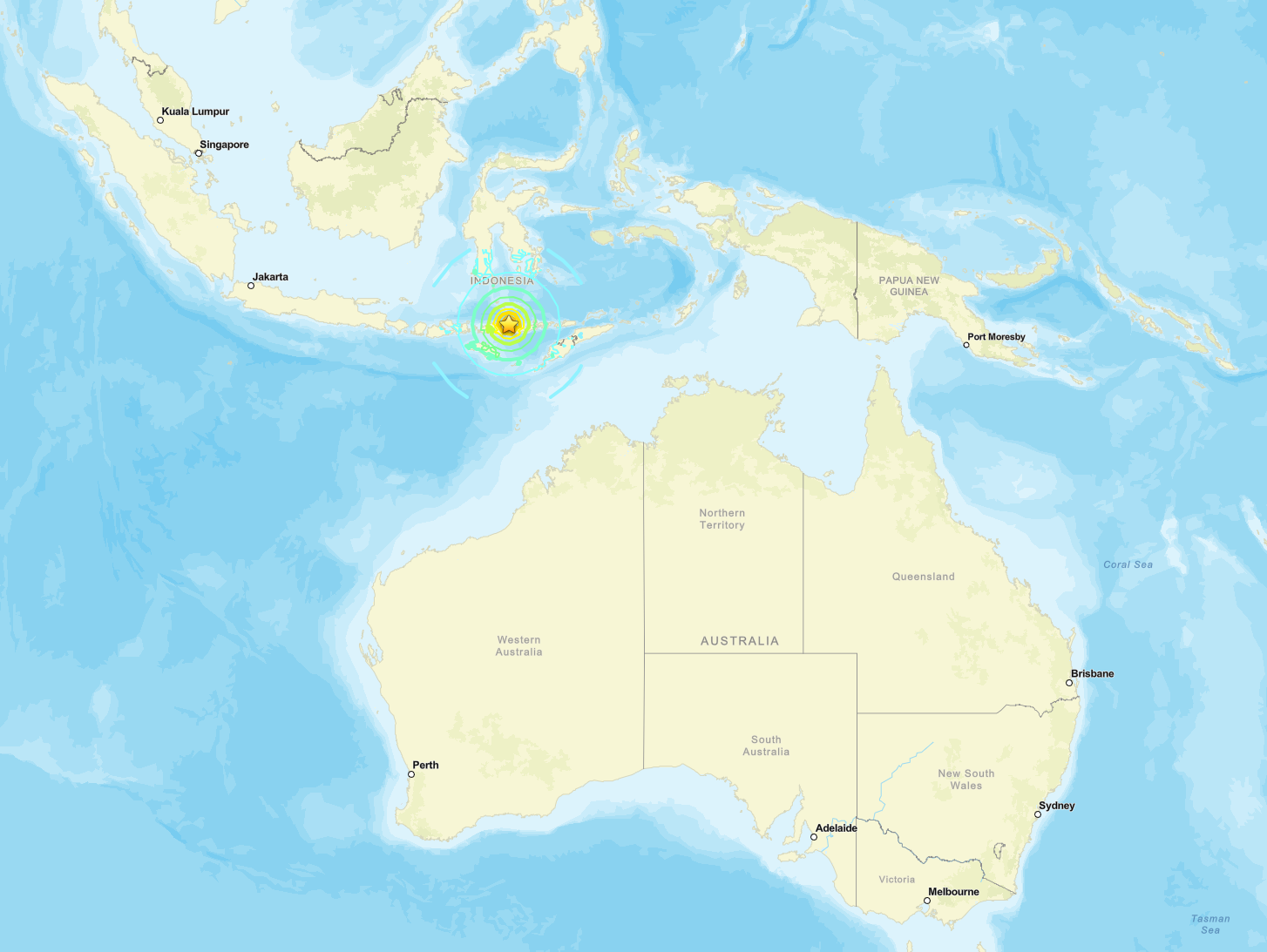


The shallow crustal event was centered at 8.310 degrees S, 121.352 degrees E, 42 miles (68 km) north-northwest of Ende on Flores Island in East Nusa Tenggara (NTT).
The United States Geological Survey classified the event as reviewed. The rupture occurred as reverse faulting within the overriding Sunda plate amid convergence between the Australia and Sunda plates. Approximately 1.17 million people experienced strong shaking (MMI VI) or higher.
Indonesia’s Meteorology, Climatology, and Geophysics Agency (BMKG) issued a tsunami early warning for coastal areas of East Nusa Tenggara (NTT), West Nusa Tenggara (NTB), South Sulawesi, and Southeast Sulawesi. Aftershocks are underway.
BMKG later recorded observed tsunami waves at multiple coastal stations, with the highest reading 0.94 m at Maurole.
The mainshock was followed within the first hour by several larger aftershocks in the same region, including events of magnitude 5.9, 6.1 and higher recorded by USGS and BMKG.
Key Seismic Parameters
Magnitude: Mw (Magnitude) 7.7 (USGS) / M 7.7 (BMKG)
Depth: 6.2 miles (10 km), shallow crustal; BMKG lists 9.3 miles (15 km)
Epicenter coordinates: 8.310°S 121.352°E
Time: 5:58 a.m. local time (9:58:21 p.m. UTC on August 14)
Location: 42 miles (68 km) north-northwest of Ende, Flores Sea, East Nusa Tenggara, Indonesia
Focal Mechanism: reverse (thrust) faulting; nodal planes strike 283° dip 64° rake 104° and strike 73° dip 29° rake 63°
Tectonic Setting: intraplate reverse faulting within the Sunda plate, approximately 217 miles (350 km) north of the Sunda Trench
PAGER Alert Level: Yellow
ShakeMap peak intensity: MMI VIII (Severe)
Tsunami Warning Status: BMKG early warning (PD-2) active for NTT, NTB, South Sulawesi, and Southeast Sulawesi coasts; observed waves recorded at multiple stations
