


GULF OF AMERICA — Hurricane Isaias is strengthening over the Gulf of America and is forecast to reach the northern Gulf Coast as a strong hurricane late Friday or early Saturday, with a storm surge expected from the Mouth of the Mississippi River to the Suwannee River, Florida.
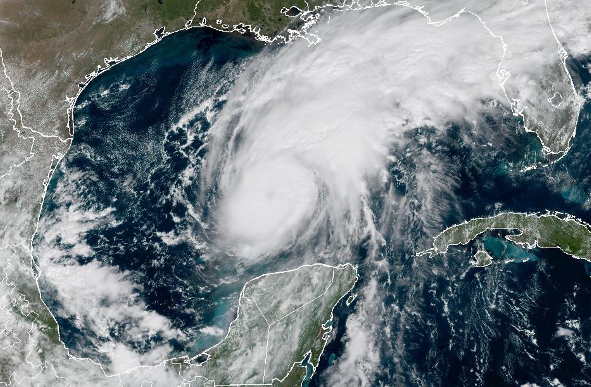


Isaias had maximum sustained winds of 85 mph (140 km/h) and a central pressure of 975 mb (975 hPa), and it was moving east-northeast at 10 mph (17 km/h).
Additional strengthening is expected through early Friday. Isaias is forecast to remain a strong hurricane as it approaches the northern Gulf Coast inside the warning area late Friday or early Saturday.
The U.S. Coast Guard Heartland Office stated on October 8 that it is preparing and will respond to impacts from Hurricane Isaias, which is expected to make landfall along the Northern Gulf Coast on Friday.
The office noted that its ability to conduct rescues can be diminished or unavailable at the height of a storm, and that once conditions allow, the Coast Guard will work with local first responders and federal partners to provide life-saving support in affected areas.
At 1:00 PM CDT (6:00 PM UTC) on October 8, the National Hurricane Center also reported a Category 1 storm about 185 miles (300 km) north of Progreso, Mexico, and 355 miles (570 km) south of the Mouth of the Mississippi River, near 24.0N 89.8W.
