
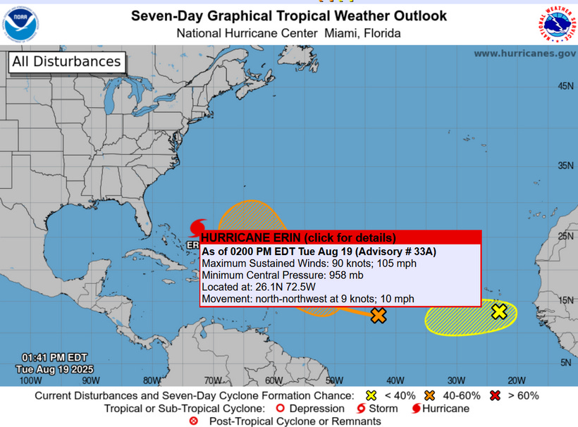
Hurricane Erin Status and Projections as of August 19, 2025
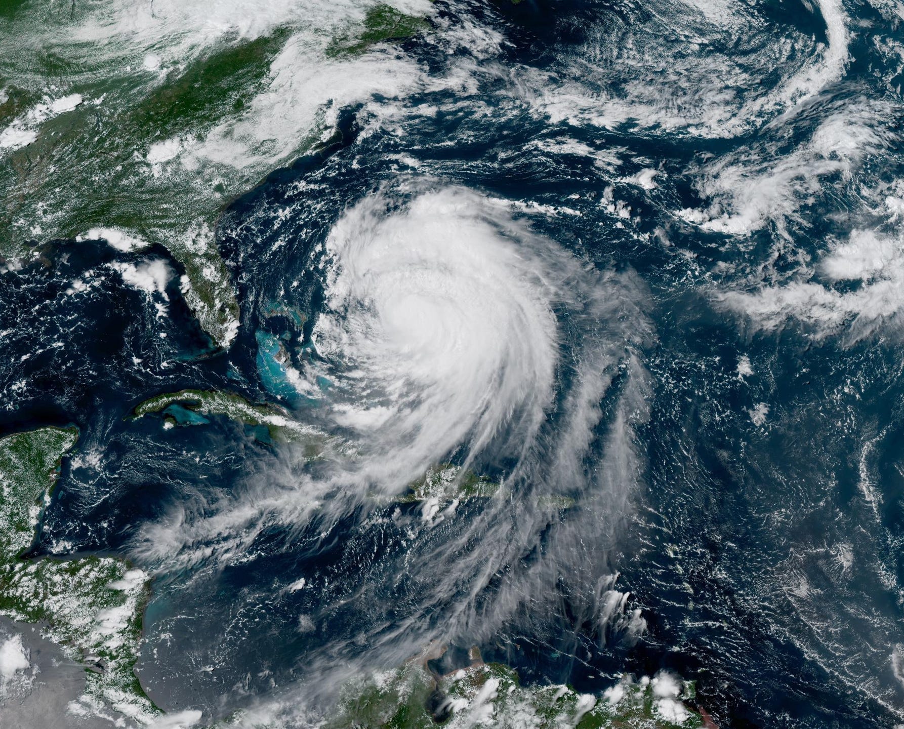
The system has evolved from a tropical depression to a Category 2 hurricane with sustained winds of 105 mph after having been strengthened to Category 5, and then weakened.


NORTH ATLANTIC — CARIBBEAN SEA AND THE GULF OF MEXICO — Since August 11, the system has evolved from a tropical depression to a Category 2 hurricane with sustained winds of 105 mph after having been strengthened to Category 5, and then weakened.


Hurricane Erin originated as a tropical wave off the African coast, becoming Tropical Depression Five on August 11 near Cabo Verde and intensifying to Tropical Storm Erin later that day.
Category 1 hurricane status was reached on August 15, with rapid intensification to Category 5 on August 16 before weakening due to an eye-wall replacement cycle. By August 19, vertical wind shear has positioned the low-level center near the northwestern edge of deep convection, with defined banding in the eastern semicircle.
The hurricane's large size has led to expanded wind fields, as indicated by global models. Hurricane-force winds extend up to 80 miles from the center, while tropical-storm-force winds reach up to 230 miles outward.
Quadrant-specific radii for 34-kt winds include 180 nautical miles northeast and southeast, 150 southwest, and 160 northwest.
Current Position and Conditions
 | A guest post by
|