
U.S. Airspace Restriction Off Puerto Rico Coast Amid Reported GPS Interference in Venezuelan Waters
The restricted zone lies directly in front of José Aponte de la Torre Airport in Ceiba, which supports United States military operations.


CARIBBEAN — The Federal Aviation Administration implemented a temporary flight restriction over a narrow ocean corridor south of Puerto Rico’s eastern coast, effective from November 1, 2025, through March 31, 2026.
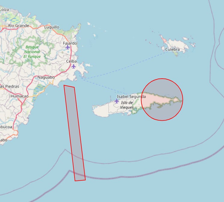


This measure designates the area as national defense airspace, prohibiting unauthorized aircraft entry. The restricted zone lies directly in front of José Aponte de la Torre Airport in Ceiba, which supports United States military operations.
Separately, Global Positioning System interference data dated October 29, 2025, indicates disruptions in northeastern Venezuela, with elevated levels observed near Sucre and Delta Amacuro states, extending toward Trinidad and Tobago.
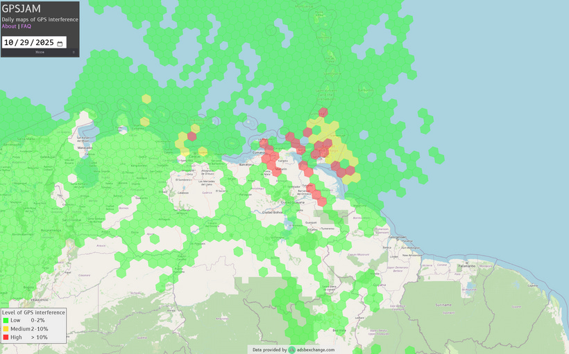
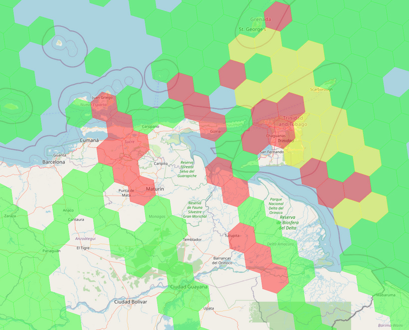
Available information does not establish a direct connection between these interference patterns and the airspace restriction in Puerto Rico.
The airport, formerly known as Roosevelt Roads Naval Station, facilitates United States counter-narcotics missions in the Caribbean region. A United States Air Force C-5 Galaxy aircraft was present at the facility on September 13, in support of logistical functions.
United States Marine Corps F-35B aircraft conducted operations there during exercises in late September and early October. The restriction implementation corresponds with heightened security measures in response to regional dynamics.
As of November 1, 2025, no modifications to the notice to airmen have been issued.
Airspace Restriction, GPS Interference Details:
 | A guest post by
|